|
The
'Great Ottery Hailstorm' of the 30th October 2008
The 30th October 2008 has got to
be one of the most memorable 'weather' nights ever. A
thunderstorm with hail of the intensity I have not witnessed before.
|
 |
 |
 |
|
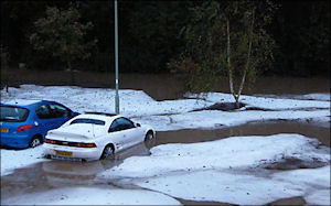
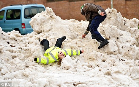
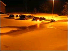
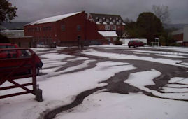
This picture shows the depth of
the hail stones (not snow as the mdeia reported) at one of
the lowest points in Ottery St Mary. The rain had washed the
hailstones down from higher ground and they all collected
here, blocking all the drains. |
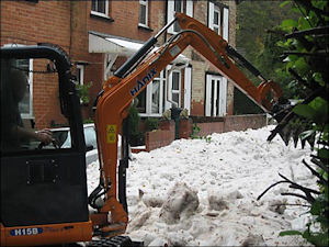
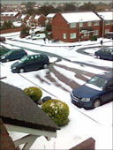
This looks like a snowy scene
more typical of January. Then again, even in January snow is
a rare sight, let alone in October. Actually, this is a hail
scene but from a distance it does look like snow. |
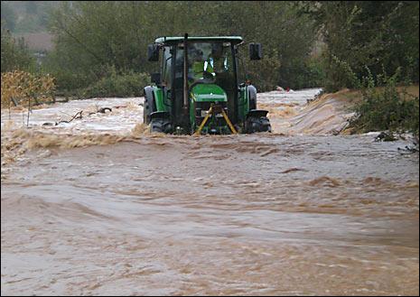
You can see where the hail had
been washed down to the lower points of the Otter Valley by
the prolonged torrential rain. |
|
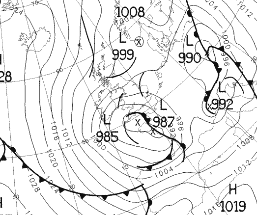
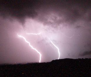
The evening
of the 29th October started very much normal with just
steady rain and a temperature around 6°C. This carried on
until 23:45 when the first flash of ligntning occurred, and
it was directly overhead. The rain intensity then started to
increase and the lightning became progeressively more
frequent with overhead flashes accompanied by immediate,
deafening claps of thunder every 30 seconds or so. By 00:30
the rain was torrential and hail started to fall as well but
the really heavy hail did not fall for another 15 to 20
minutes though by 01:00 the hail and rain were evenly mixed.
At this location the hail did not accumulate much as we are
situtated on a slight hill so all the hail was being washed
away in all directions. Interesting to note though that I
have never recorded hail and rain together with such
intensity and to last so long i.e., more than 1½ hours.
At 01:15 the
rain was falling at a rate of 10 mm every 15 minutes and
with the hail it sounded like an express train was
thundering along the roof of the house. The thunder and
lightning was spectacular with frequent, multiple overhead
flashes and of such a brightness I have not experienced
before. |
|
|
To describe the
intensity of the rainfall is hard, but if you imagine a summer
thunderstorm when you often get a short but incredible deluge of
rain that seems to flood everywhere in just a few minutes, then that
would be similar to the rainfall that was occurring during this
storm, but instead of lasting 5 or 10 minutes, this lasted 2 hours.
41 mm of rain fell
between 00:00 and 03:00 with a total of 71 mm falling between
midnight and 08:00. It must be noted though that these figures
probably under-represent the real rain that fell due to the gauges
getting blocked by hailstones.
The media was
reporting that snow was falling but I can write here that there
definitely was no snow, just hail and lots of it. |
 |
|
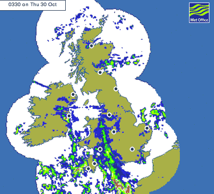
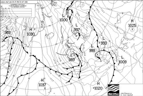
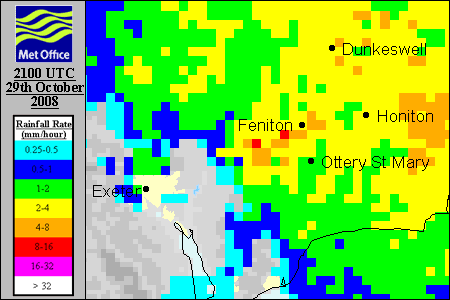
Met Office rainfall
radar of the Otter Valley from 21:00 to 03:00. |
|
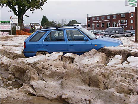 |
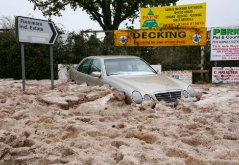
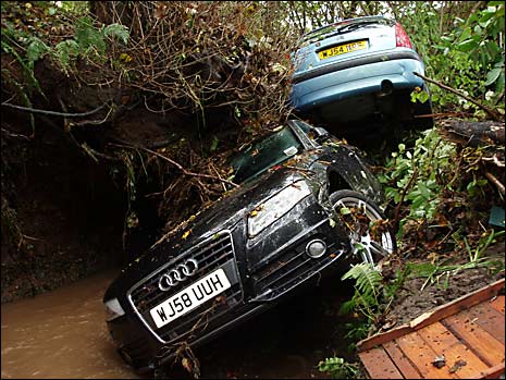
The town of
Ottery St Mary was particularly badly affected as the town is
situated quite low down in the Otter Valley and surrounded by
hills and higher ground. The streets were turned into rivers
which was washing the hail to the lowest point in the town which
was the Finnimore Indutrial Estate where the hail collected in
large drifts over a metre deep in places.
|
|
A car entombed in
hail ice on the Finnimore Industrial Estate, Ottery St Mary |
|
|
|
|
|
|